
Scan to BIM
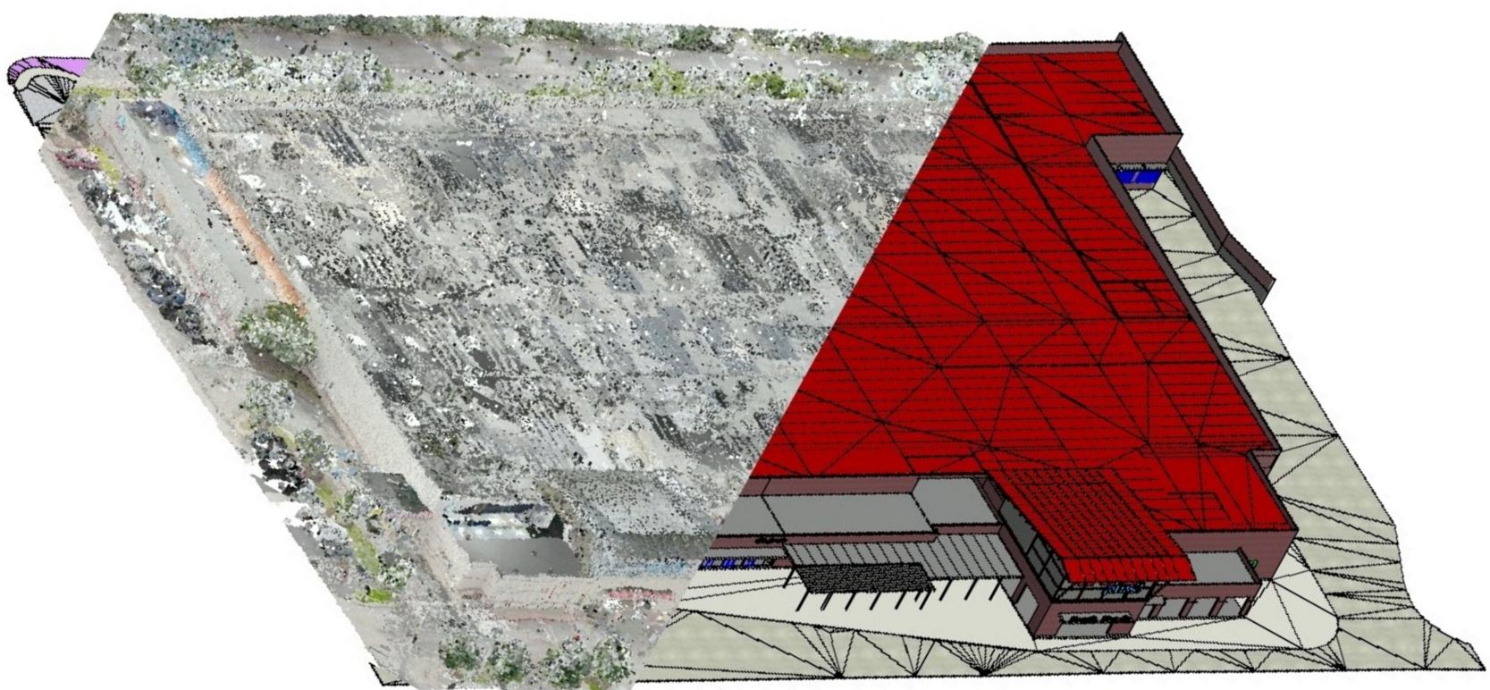
Point cloud is a set of multiple data points essentially in a 3D coordinate system which helps to represent external and internal surface/elements of a particular building This 3D scanned data will document every single detail. This also helps to eliminate the need for repeated site visits.The different sectors including Retailers, Main Contractors, and Architects. Even widely used by MEP designers, MEP contractors, and consulting engineers in order to analyze the differences between Point cloud and model geometry by creating native Revit geometry from and to a point cloud.data can be exported or imported in a format understandable by electronic surveying equipment that will enable you to read the survey data for as-built conditions and to export design data for field verification.helps create as-built BIM Models for retrofit, refurbishment and renovation projects.to create as-built BIM models for MEP services that help the managers provide early clash detection alerts.creation of intelligent BIM model in Revit by providing accurate point cloud data to the clients.helps measure points within the scan to find true dimensions quickly.